Weather Alert in Illinois
Flood Warning issued April 3 at 12:14PM EDT by NWS Indianapolis IN
AREAS AFFECTED: Crawford, IL; Lawrence, IL; Knox, IN; Sullivan, IN
DESCRIPTION: ...The National Weather Service in Indianapolis IN has issued a Flood Warning for the following rivers in Indiana...Illinois... Wabash River at Riverton. .Multiple rounds of rainfall have brought lowland flooding to the Wabash River basin. The Wabash is expected to crest at Lafayette on Sunday, but the crest is not expected to reach the lower Wabash until the weekend of April 11th. The current river forecast includes expected rainfall amounts of 0.75 to 1.25 inches in the Wabash basin through Sunday morning, when dry weather is expected to move into the area. Variations from those expected amounts could change the crests as well as the amount of time spent in flood at any given location. * WHAT...Minor flooding is forecast. * WHERE...Wabash River at Riverton. * WHEN...From late tonight until further notice. * IMPACTS...At 18.5 feet, High water surrounds elevated river cabins. County roads to these cabins are impassable. Agricultural flooding is in progress. Seep water develops behind levees. * ADDITIONAL DETAILS... - At 11:00 AM EDT Friday /10:00 AM CDT Friday/ the stage was 11.7 feet. - Forecast...The river is expected to rise above flood stage late tonight and continue rising to a crest of 19.2 feet Friday, April 10. - Flood stage is 15.0 feet. - http://www.weather.gov/safety/flood
INSTRUCTION: Turn around, don't drown when encountering flooded roads. Most flood deaths occur in vehicles. Motorists should not attempt to drive around barricades or drive cars through flooded areas. Additional information is available at www.weather.gov/ind. The next statement should be issued this evening by around 1130 PM EDT /1030 PM CDT/.
Want more detail? Get the Complete 7 Day and Night Detailed Forecast!
Current U.S. National Radar--Current
The Current National Weather Radar is shown below with a UTC Time (subtract 5 hours from UTC to get Eastern Time).

National Weather Forecast--Current
The Current National Weather Forecast and National Weather Map are shown below.

National Weather Forecast for Tomorrow
Tomorrow National Weather Forecast and Tomorrow National Weather Map are show below.

North America Water Vapor (Moisture)
This map shows recent moisture content over North America. Bright and colored areas show high moisture (ie, clouds); brown indicates very little moisture present; black indicates no moisture.

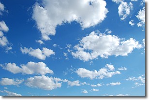
Weather Topic: What are Cumulonimbus Clouds?
Home - Education - Cloud Types - Cumulonimbus Clouds
 Next Topic: Cumulus Clouds
The final form taken by a growing cumulus cloud is the
cumulonimbus cloud, which is very tall and dense.
The tower of a cumulonimbus cloud can soar 23 km into the atmosphere, although
most commonly they stop growing at an altitude of 6 km.
Even small cumulonimbus clouds appear very large in comparison to other cloud types.
They can signal the approach of stormy weather, such as thunderstorms or blizzards.
Next Topic: Cumulus Clouds
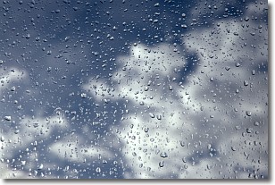
Weather Topic: What is Drizzle?
Home - Education - Precipitation - Drizzle
 Next Topic: Evaporation
Drizzle is precipitation in the form of water droplets which are
smaller than raindrops.
Drizzle is characterized by fine, gently falling droplets and typically does not
impact human habitation in a negative way. The exception to this is freezing drizzle,
a condition where drizzle freezes immediately upon reaching earth's surface.
Freezing drizzle is still less dangerous than freezing rain, but can
potentially result in hazardous road conditions.
Next Topic: Evaporation
Current conditions powered by WeatherAPI.com


