Weather Alert in Michigan
Winter Storm Warning issued April 2 at 4:38PM EDT until April 3 at 2:00AM EDT by NWS Marquette MI
AREAS AFFECTED: Gogebic; Iron; Dickinson
DESCRIPTION: * WHAT...For the Winter Storm Warning, heavy mixed precipitation. Additional snow and sleet accumulations less than one inch and ice accumulations around two tenths of an inch. For the Winter Storm Watch, heavy mixed precipitation possible. Total snow and sleet accumulations less than one inch and ice accumulations between three tenths and four tenths of an inch possible. * WHERE...Dickinson, Iron, and Gogebic Counties. * WHEN...For the Winter Storm Warning, until 1 AM CDT Friday. For the Winter Storm Watch, from Friday evening through Saturday morning. * IMPACTS...Power outages and tree damage are possible due to the ice. Travel could be difficult. The hazardous conditions will impact the Thursday evening and Friday morning commutes. * ADDITIONAL DETAILS...Accumulating sleet will be difficult to remove.
INSTRUCTION: If you must travel, keep an extra flashlight, food, and water in your vehicle in case of an emergency. Prepare for possible power outages. Monitor the latest forecasts for updates on this situation.
Want more detail? Get the Complete 7 Day and Night Detailed Forecast!
Current U.S. National Radar--Current
The Current National Weather Radar is shown below with a UTC Time (subtract 5 hours from UTC to get Eastern Time).

National Weather Forecast--Current
The Current National Weather Forecast and National Weather Map are shown below.

National Weather Forecast for Tomorrow
Tomorrow National Weather Forecast and Tomorrow National Weather Map are show below.

North America Water Vapor (Moisture)
This map shows recent moisture content over North America. Bright and colored areas show high moisture (ie, clouds); brown indicates very little moisture present; black indicates no moisture.

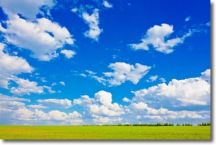
Weather Topic: What are Cumulus Clouds?
Home - Education - Cloud Types - Cumulus Clouds
 Next Topic: Drizzle
Cumulus clouds are fluffy and textured with rounded tops, and
may have flat bottoms. The border of a cumulus cloud
is clearly defined, and can have the appearance of cotton or cauliflower.
Cumulus clouds form at low altitudes (rarely above 2 km) but can grow very tall,
becoming cumulus congestus and possibly the even taller cumulonimbus clouds.
When cumulus clouds become taller, they have a greater chance of producing precipitation.
Next Topic: Drizzle
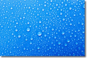
Weather Topic: What is Evaporation?
Home - Education - Precipitation - Evaporation
 Next Topic: Fog
Evaporation is the process which returns water from the earth
back to the atmosphere, and is another crucial process in the water cycle.
Evaporation is the transformation of liquid into gas, and it happens because
molecules are excited by the application of energy and turn into vapor.
In order for water to evaporate it has to be on the surface of a body of water.
Next Topic: Fog
Current conditions powered by WeatherAPI.com


