Weather Alert in Illinois
Flood Watch issued April 3 at 11:56PM CDT until April 4 at 10:00AM CDT by NWS Chicago IL
AREAS AFFECTED: Winnebago; Boone; McHenry; Lake; Ogle; Lee; De Kalb; Kane; DuPage; La Salle; Kendall; Grundy; Kankakee; Livingston; Iroquois; Ford; Northern Cook; Central Cook; Southern Cook; Northern Will; Southern Will; Eastern Will; Lake; Porter; Newton; Jasper; Benton
DESCRIPTION: * WHAT...Flash flooding caused by excessive rainfall continues to be possible. * WHERE...Portions of northern and central Illinois and northwest Indiana. * WHEN...Until 10 AM CDT /11 AM EDT/ Saturday. * IMPACTS...Roads and streets may be flooded. Area creeks and streams are already elevated, increasing the risk of flooding due to additional rainfall. * ADDITIONAL DETAILS... - Recent rounds of heavy rainfall have left soils saturated and stream and creek levels elevated across the area. Additional rounds of heavy rainfall overnight may lead to rapid run-off and an increased threat of flash flooding. - http://www.weather.gov/safety/flood
INSTRUCTION: A Flood Watch for flash flooding means rapid-onset flooding is possible, but not yet certain, based upon the latest forecasts. Flash flooding is a dangerous situation. Persons with interests along area rivers, creeks, and other waterways should monitor the latest forecasts and be prepared to take action should flooding develop.
Want more detail? Get the Complete 7 Day and Night Detailed Forecast!
Current U.S. National Radar--Current
The Current National Weather Radar is shown below with a UTC Time (subtract 5 hours from UTC to get Eastern Time).

National Weather Forecast--Current
The Current National Weather Forecast and National Weather Map are shown below.

National Weather Forecast for Tomorrow
Tomorrow National Weather Forecast and Tomorrow National Weather Map are show below.

North America Water Vapor (Moisture)
This map shows recent moisture content over North America. Bright and colored areas show high moisture (ie, clouds); brown indicates very little moisture present; black indicates no moisture.

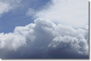
Weather Topic: What are Nimbostratus Clouds?
Home - Education - Cloud Types - Nimbostratus Clouds
 Next Topic: Precipitation
A nimbostratus cloud is similar to a stratus cloud in its formless,
smooth appearance. However, a nimbostratus cloud is darker than a stratus cloud,
because it is thicker.
Unlike a stratus cloud, a nimbostratus cloud typically brings with it the threat
of moderate to heavy precipitation. In some cases, the precipitation may evaporate
before reaching the ground, a phenomenon known as virga.
Next Topic: Precipitation
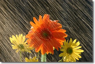
Weather Topic: What is Rain?
Home - Education - Precipitation - Rain
 Next Topic: Shelf Clouds
Precipitation in the form of water droplets is called rain.
Rain generally has a tendency to fall with less intensity over a greater period
of time, and when rainfall is more severe it is usually less sustained.
Rain is the most common form of precipitation and happens with greater frequency
depending on the season and regional influences. Cities have been shown to have
an observable effect on rainfall, due to an effect called the urban heat island.
Compared to upwind, monthly rainfall between twenty and forty miles downwind of
cities is 30% greater.
Next Topic: Shelf Clouds
Current conditions powered by WeatherAPI.com


