Weather Alert in Illinois
Flood Warning issued April 2 at 12:13PM EDT until April 12 at 11:17AM EDT by NWS Indianapolis IN
AREAS AFFECTED: Clark, IL; Crawford, IL; Sullivan, IN; Vigo, IN
DESCRIPTION: ...The National Weather Service in Indianapolis IN has issued a Flood Warning for the following rivers in Indiana...Illinois... Wabash River at Terre Haute. Wabash River at Hutsonville Legacy Power Plant Site. .Multiple rounds of rainfall will bring minor lowland flooding to the Wabash River basin that could hang around through much of next week. The current river forecasts include around an inch of rainfall through Saturday morning, but do not include rainfall from Saturday through Sunday. Higher rainfall amounts in the Wabash basin could increase crests or lengthen the amount of time in flood. * WHAT...Minor flooding is forecast. * WHERE...Wabash River at Terre Haute. * WHEN...From Friday evening to Sunday, April 12. * IMPACTS...At 22.0 feet, Pottsville Street just northwest of Terre Haute is flooded. Lowland flooding in progress with several river roads flooded in Clark County Illinois. * ADDITIONAL DETAILS... - At 11:30 AM EDT Thursday /10:30 AM CDT Thursday/ the stage was 10.7 feet. - Forecast...The river is expected to rise above flood stage tomorrow evening to a crest of 21.8 feet early Tuesday afternoon. It will then fall below flood stage Saturday, April 11. - Flood stage is 16.5 feet. - http://www.weather.gov/safety/flood
INSTRUCTION: Turn around, don't drown when encountering flooded roads. Most flood deaths occur in vehicles. Motorists should not attempt to drive around barricades or drive cars through flooded areas. Additional information is available at www.weather.gov/ind. The next statement should be issued late tonight by around 200 AM EDT /100 AM CDT/.
Want more detail? Get the Complete 7 Day and Night Detailed Forecast!
Current U.S. National Radar--Current
The Current National Weather Radar is shown below with a UTC Time (subtract 5 hours from UTC to get Eastern Time).

National Weather Forecast--Current
The Current National Weather Forecast and National Weather Map are shown below.

National Weather Forecast for Tomorrow
Tomorrow National Weather Forecast and Tomorrow National Weather Map are show below.

North America Water Vapor (Moisture)
This map shows recent moisture content over North America. Bright and colored areas show high moisture (ie, clouds); brown indicates very little moisture present; black indicates no moisture.

Weather Topic: What is Drizzle?
Home - Education - Precipitation - Drizzle
 Next Topic: Evaporation
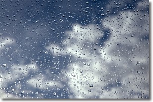
Drizzle is precipitation in the form of water droplets which are
smaller than raindrops.
Drizzle is characterized by fine, gently falling droplets and typically does not
impact human habitation in a negative way. The exception to this is freezing drizzle,
a condition where drizzle freezes immediately upon reaching earth's surface.
Freezing drizzle is still less dangerous than freezing rain, but can
potentially result in hazardous road conditions.
Next Topic: Evaporation
Weather Topic: What is Fog?
Home - Education - Cloud Types - Fog
 Next Topic: Fractus Clouds
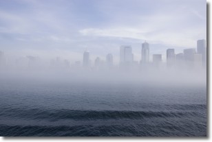
Fog is technically a type of stratus cloud, which lies along the
ground and obscures visibility.
It is usually created when humidity in the air condenses into tiny water droplets.
Because of this, some places are more prone to foggy weather, such as regions
close to a body of water.
Fog is similar to mist; both are the appearance of water droplets suspended in
the air, but fog is the term applied to the condition when visibility is less than 1 km.
Next Topic: Fractus Clouds
Current conditions powered by WeatherAPI.com


