Weather Alert in Ohio
Flood Warning issued April 4 at 7:58PM EDT until April 8 at 10:00PM EDT by NWS Cleveland OH
AREAS AFFECTED: Holmes, OH; Wayne, OH
DESCRIPTION: ...The Flood Warning continues for the following rivers in Ohio... Sandusky River At Tiffin affecting Seneca County. Maumee River At Waterville affecting Wood and Lucas Counties. Killbuck Creek Near Killbuck affecting Wayne and Holmes Counties. For the Sandusky River...including Upper Sandusky, Fremont, Tiffin, Bucyrus...Minor flooding is forecast. For the Maumee River...including Grand Rapids, Waterville...Minor flooding is forecast. For the Killbuck Creek...including Killbuck...Moderate flooding is forecast. * WHAT...Moderate flooding is occurring and moderate flooding is forecast. * WHERE...Killbuck Creek near Killbuck. * WHEN...Until late Wednesday evening. * IMPACTS...At 17.0 feet, Private property on Water Street in the Village of Killbuck flooded. Several county and local roads impassable including State Route 60 south and County Road 621. * ADDITIONAL DETAILS... - At 7:00 PM EDT Saturday the stage was 17.4 feet. - Forecast...The river is expected to fall below flood stage Wednesday afternoon and continue falling to 13.9 feet early Thursday afternoon. - Flood stage is 15.0 feet. - Flood History...This crest compares to a previous crest of 17.4 feet on 06/17/1946. - Please visit www.weather.gov/safety/flood for flood safety and preparedness information.
INSTRUCTION: Turn around, don't drown when encountering flooded roads. Most flood deaths occur in vehicles. Be especially cautious at night when it is harder to recognize the dangers of flooding. Additional information is available at www.weather.gov/cle. The next statement will be issued Sunday morning at 600 AM EDT.
Want more detail? Get the Complete 7 Day and Night Detailed Forecast!
Current U.S. National Radar--Current
The Current National Weather Radar is shown below with a UTC Time (subtract 5 hours from UTC to get Eastern Time).

National Weather Forecast--Current
The Current National Weather Forecast and National Weather Map are shown below.

National Weather Forecast for Tomorrow
Tomorrow National Weather Forecast and Tomorrow National Weather Map are show below.

North America Water Vapor (Moisture)
This map shows recent moisture content over North America. Bright and colored areas show high moisture (ie, clouds); brown indicates very little moisture present; black indicates no moisture.

Weather Topic: What is Drizzle?
Home - Education - Precipitation - Drizzle
 Next Topic: Evaporation
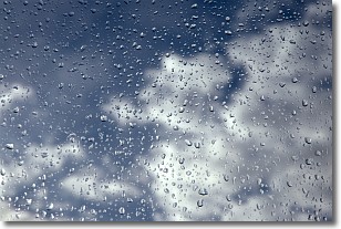
Drizzle is precipitation in the form of water droplets which are
smaller than raindrops.
Drizzle is characterized by fine, gently falling droplets and typically does not
impact human habitation in a negative way. The exception to this is freezing drizzle,
a condition where drizzle freezes immediately upon reaching earth's surface.
Freezing drizzle is still less dangerous than freezing rain, but can
potentially result in hazardous road conditions.
Next Topic: Evaporation
Weather Topic: What is Fog?
Home - Education - Cloud Types - Fog
 Next Topic: Fractus Clouds
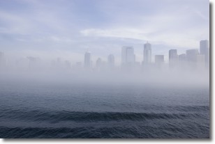
Fog is technically a type of stratus cloud, which lies along the
ground and obscures visibility.
It is usually created when humidity in the air condenses into tiny water droplets.
Because of this, some places are more prone to foggy weather, such as regions
close to a body of water.
Fog is similar to mist; both are the appearance of water droplets suspended in
the air, but fog is the term applied to the condition when visibility is less than 1 km.
Next Topic: Fractus Clouds
Current conditions powered by WeatherAPI.com


